Carkeek hut was built in 1962 by the NZ Forest Service during the hut building program to support the deer culling operations in the forest park. The hut is one of 14 6 bunk S70 type Forest Service huts that were built along with 6 2 person “dog box” type bivouacs.
The exNZFS volunteer group have an agreement with DOC to manage this hut. The exNZFS is a group of volunteers that were employed by the NZ Forest Service as deer cullers. The aim of the group is to ensure the historical integrity of these iconic reminders of the deer culling era is retained. This group have management agreements with DOC to manage 12 huts in the Tararua, Remutaka and Aorangi forest parks.
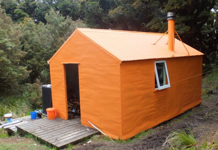
Carkeek hut is located in the central Tararua Forest Park and is one of the most remote huts in the park.
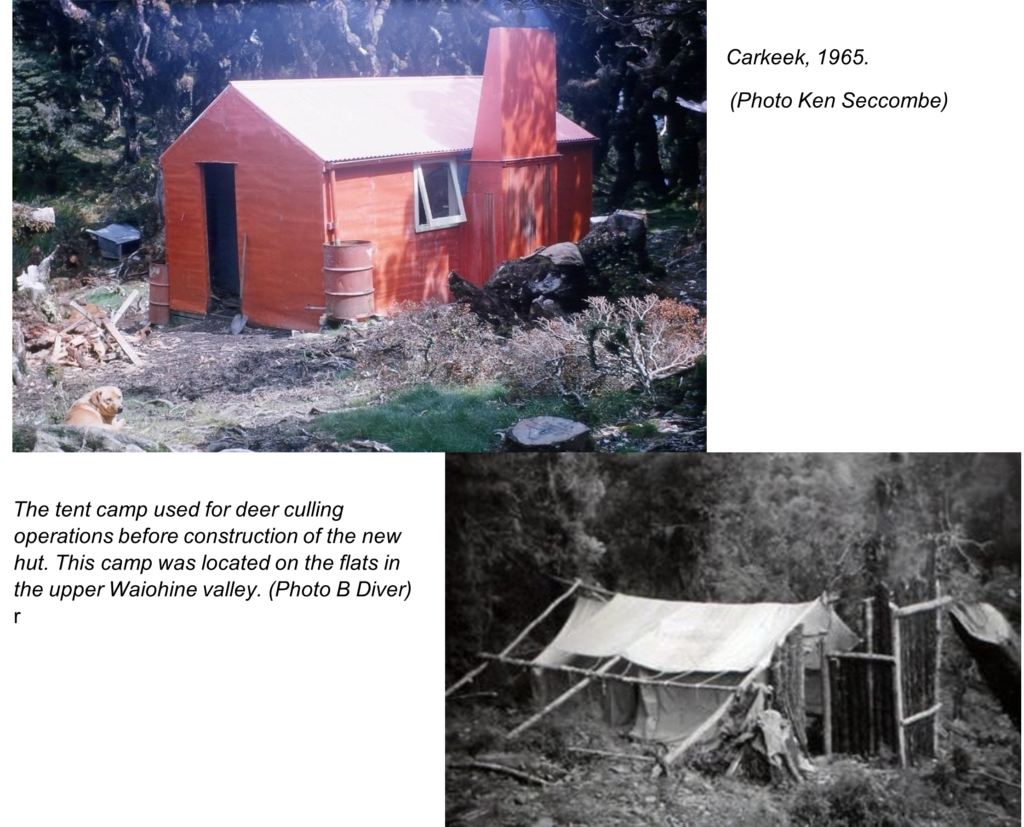
Carkeek hut was built in in 1962 to support the NZ Forest Service deer culling operations. Materials were air dropped from fixed wing aircraft by parachute. Prior to the hut being built, cullers used a tent camp located in the upper Waiohine valley (see photo below).
Initially, the hut had an open fire place for cooking and heating. Due to shortage of firewood at this altitude, a wood burner was installed. Otherwise, the hut still meets the design specifications of the NZFS S70 type huts used throughout NZ.
Since the exNZFS group took over upkeep of the hut, the original interior and exterior paint colours have been adopted.
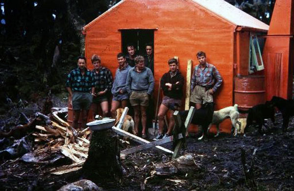
Photo above – Forest Service hunters at a new Carkeek Hut, about 1965. L to R: Athol Geddes, Colin McIntyre, Ross Locker (trainee) Russell Hulme, Dick Hetherington, Aubrey Hohua, Tony Newton (trainee), Jim Taylor. Russell Hulme recalls: “It was an unusual situation in that two or three parties met at Carkeek. Athol was on some kind of inspection. His party had come up the Main Range to Nichols Hut and across to Carkeek. It was shortly after Nichols had been built and he wasn’t impressed by the tilt on the floor, no one was.” (Photo A Geddes)
Carkeek tracks
Several old tracks leading from Carkeek hut. None of these are officially maintained, and were orginally cut to support the NZFS deer culling operations. There are old tracks formed during the deer culling era by the NZ Forest Service. These are no longer officially maintained tracks, but most can still be used, with care.
Old previously cut tracks used are from Arete hut, and down Carkeek Ridge to the hut. Or from Nichols hut on the Main Range, to the Park Forks and up Carkeek ridge. The route from McGregor Bivouac to the Waiohine river, up river to Park Forks is also popular. The route from Dorset Ridge hut, down to the Park Forks is also used. All of these routes were developed in the 1950s/60s for the deer culling operations by the Forest Service. Now, all have been removed from DOCs track maintenance schedule.
To Park Forks; The old track to the Park Forks is marked with white permolat and is easy to follow. Approximate tramping time is 1 ½ – 2 hours to the Park Forks.
To McGregor Bivouac; from the Park Forks follow the river down to Dorset Creek. The river may be difficult to cross in places, if above low river flows. At Dorset creek climb the spur leading up to McGregor. This route is lightly marked with Permolat track markers. From point 1000 the route is marked but care is needed in places.
To Nichols Hut; from the Park Forks, the old track leads up the spur to Nicholls approximately 75 metres upstream from the forks. The route is mostly well marked with permolat (mainly downhill) . Allow 2 hours plus from Park Forks.
To Dorset Ridge Hut; From the Park Forks, the old track to Dorset Ridge Hut follows the main ridge. Twenty metres upstream from the forks, climb onto the toe of the ridge and climb to the bushline. The route is well marked with white Permolate (mainly downhill). Allow 3 hours plus from Park Forks.
To Tarn Ridge hut; an old (unmaintained) route leads down the spur off 1285 and over 1090 and descends to the upper Waiohine valley. The route is mrked with white Permolat from the bushedge. At the junction of the creek shown on the map below, a sparsely marked route leads up the spur to the bush edge. The climb to the top of Tarn ridge is approx 500 metres south of 1313.
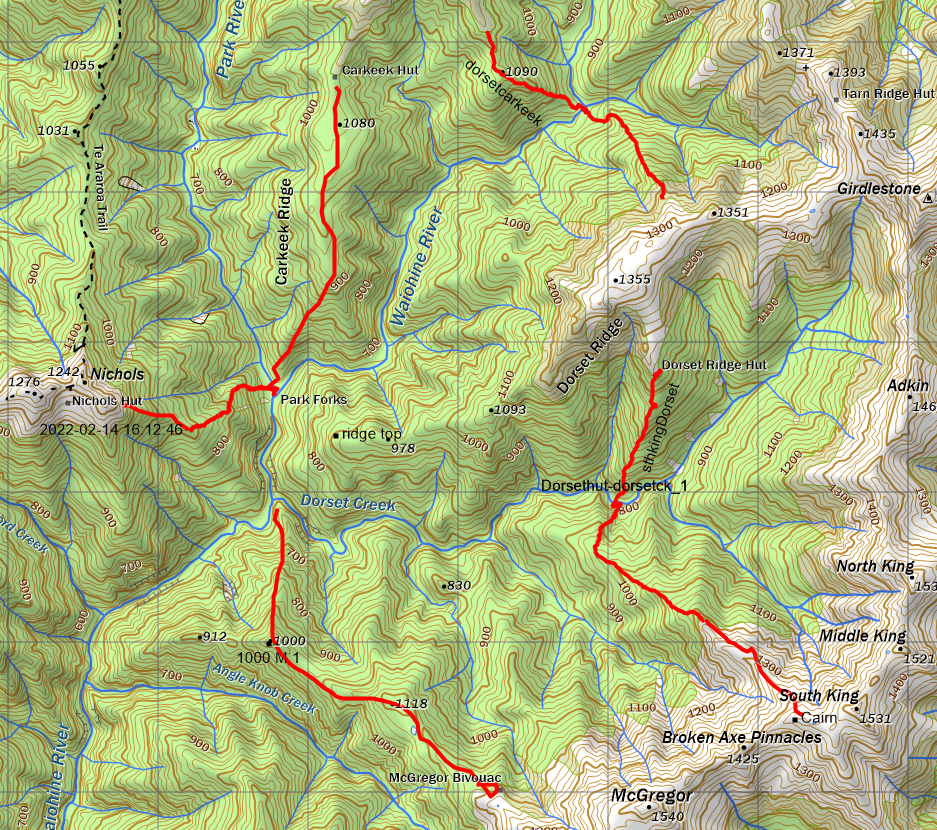
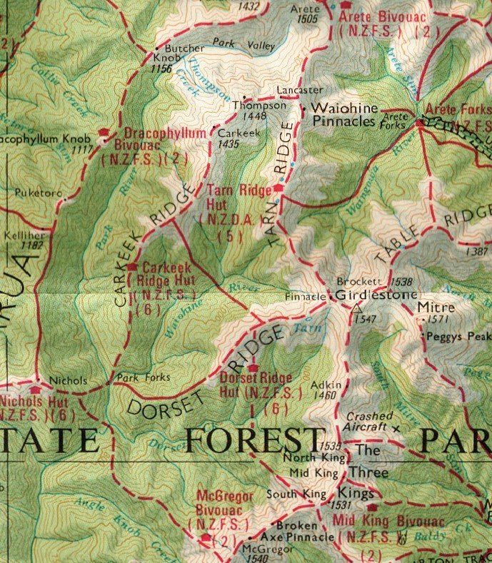
Map below – extract from 1985 NZFS Tararua Park Map showing tracks used in the 1960s in the Carkeek area
