Go to track information
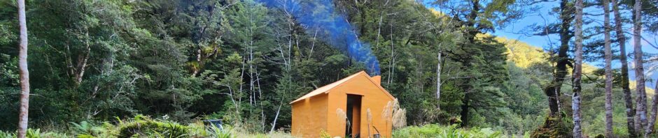
Arete Forks hut was built in 1960 by the NZ Forest Service during the hut building program to support the deer culling operations in the forest park. The hut is one of 14 6 bunk S70 type Forest Service huts that were built along with 6 2 person “dog box” type bivouacs.
The exNZFS volunteer group have an agreement with DOC to manage this hut. The exNZFS is a group of volunteers that were employed by the NZ Forest Service as deer cullers. The aim of the group is to ensure the historical integrity of these iconic reminders of the deer culling era is retained. This group have management agreements with DOC to manage 12 huts in the Tararua, Remutaka and Aorangi forest parks.
Arete Forks hut is located in the Upper Waiohine catchment in Tararua Forest Park. This hut has been restored by the exNZFS group to the original design of the Forest Service S70 type 6 bunk hut. It is now one of only two S70 type huts in the Tararua’s that are fully representative of the deer culling huts built by the NZ Forest Service.
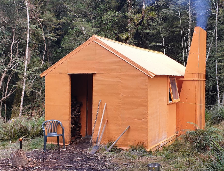
In the early 1980s the interior ceiling was modified and later a Pot belly wood burner installed. Wood burners were installed at a Department of Conservation policy to phase out open fires.
With only one hut in the Tararuas’s that still met the original S70 design, Arete Forks was a good candidate to add another hut that is representative of the deer culling huts. Initial work involved repainting the hut in original NZFS orange (actually Tangerine) in 2014.
Funding of this project was obtained from what is now the Backcountry Trust fund. This fund supports hut and track projects throughout the New Zealand backcountry. Funding was also obtained from the Tararua-Aorangi-Remutaka Huts Committee.
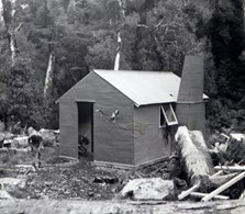
Arete Forks hut was built in 1960. Material were transported by helicopter and the construction team included Noel Frazer and Chris Main. The hut was built to the standard S70 Forest Service 6 bunk hut design.
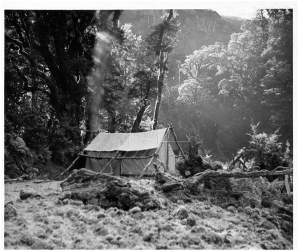
Prior to the construction of the 6 bunk S70 type hut by the Forest Service, cullers used a canvas tent camp for accommodation. Hunting was initially done during the winter months, as well as in the summer, and being a fairly shady spot, the winters were quite chilly!
TRACK INFORMATION
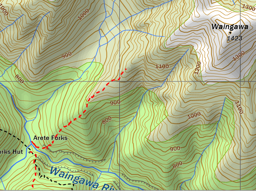
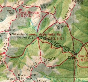
Several tracks lead to Arete Forks. Only two of the routes are offical maintained tramping tracks. Arete Forks to Cow Creek and Arete Forks to the Waiohine Pinnacles. The Waiohine Pinnacles route connects to the route on Tarn Ridge leading from Tarn Ridge hut to Arete Hut. The Carkeek Ridge near the Waiohine Pinnacles lead to Carkeek hut. Carkeek Hut.
There are old tracks formed during the deer culling era by the NZ Forest Service. These are no longer officially maintained tracks, but most can still be used, with care.
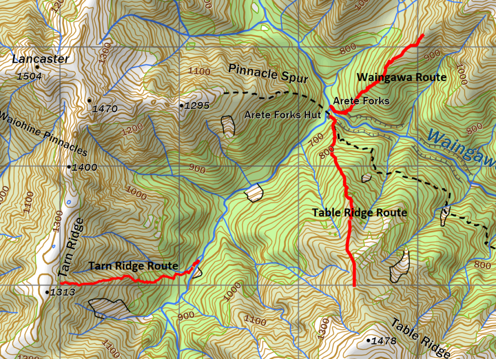
ARETE FORKS TO TABLE RIDGE
An old cullers track can still be followed to the bush edge, from Arete Forks hut. From the hut, climb the start of the Arete Sidle track that leads to Cow Creek hut. At the highest point above the hut, the old track leads up the spur to the bush edge. This route is reasonable easy to follow up or down hill, and has been marked with white Permolat (the venetian blind material used by the NZFS to mark tracks in the 1960s.) From the bush edge, it’s a straight forward climb through low scrub and tussock to the top at 1478. Occasional rock cairns have been placed along the route. A large rock cairn marks the top of Table Top. Average tramping time to the bush edge is about one hour.
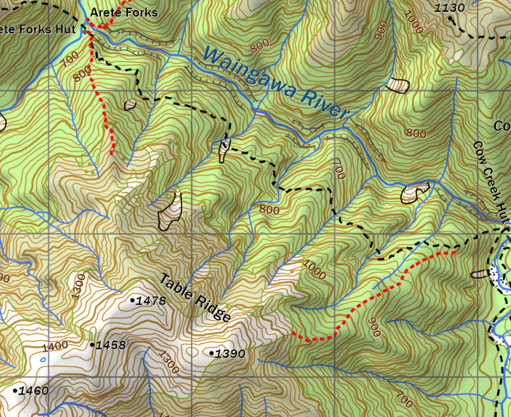
Table Ridge is sometimes used as an alternative to get to Cow creek via the Sidle track. From the highest point on Table Ridge, the route leads along to the main spur descending to Cow Creek. A small saddle on the main ridge is encountered and occasional rock cairns have been located. The route down to Cow creek descends a tussock spur off 1390. From the bush edge, the track is marked with orange DOC track markers and the track was recut several years ago. The track down joins with the Arete Sidle track not far above Cow creek hut. Approximate time to complete the whole route would be 4 to 6 hours
ARETE FORKS TO WAINGAWA
An old Forest Service track leads from Arete Forks up the leading spur to the Bannister – Waingawa ridge line. From Arete Forks the route leads up the true left of Arete Stream for about 50 metres and ascends the bush terrace above the stream bed. White Permolat markers indicate the entrance to the route. Proceed downstream on the true left along the terrace until opposite Arete Forks hut. Markers then lead up the spur to the edge of the beech forest at about the 900M altitude mark. This old track hasn’t been cut for 30 years or more, but Permolat markers can be followed ok through the beech forest. From there, the old track through the leatherwood scrub can be followed for 500 metres before a steep ascent up a rocky gut. At the top of the gut, markers cease and the route climbs through moderate leatherwood scrub and eventually to the ridge top. This is approximately 300 metres west of Waingawa (1423 metres) If descending this route, an orange track marker indicates the entrance to the rock gut that leads down to the beginning of the old track. Travel time is approximately two and half to three and half hours to the ridge top.
ARETE FORKS TO COW CREEK VIA THE GORGE.
At times of low river levels, this can be an interesting and possibly quicker route between the two huts. However there are several deep pools in the river, and numerous large boulders to deal with. Travel times can be from 3 to 4 hours, depending on river levels and fitness.
TARN RIDGE ROUTE
This route was maintained by the NZFS until the early 1980s. At Tarn Ridge, the track began not far from the original Blatchford Memorial hut site. The route was commonly used by the NZFS cullers to get from/to Arete Forks to Carkeek and Dorset Ridge huts. (the route to Carkeek involved descending to the upper Waiohine and onto Carkeek Ridge at 1285.
The route begins at the Waingawa river approximately 1.75kms upstream from Arete Forks hut at the confluence of a small stream draining off Tarn Ridge. The river bed opens out just downstream, due to a massive flood in the 1990s that took away much of the stream bank and trees with it. White Permolat markers indicated the start of the route on the true left of the river bed. The route is marked and straight forward uphill to the start of the leatherwood belt. The old track was completely over grown but a route exists uphill until stunted leatherwood is reached and then on to the top of Tarn Ridge. A wooden marker pole on the east side of the ridge marks the start of the descent down the route. From here, it is about 1 hour or less, to Tarn Ridge hut. Time from Arete Forks to the route start is approx. 1 hour.
Time from the river bed to the top of Tarn Ridge is approx. 2 hours
There are alternative routes to get to Tarn Ridge hut from Arete Forks. One is by descending down to the upper Waingawa from 1393 direct to the river. A rough short stretch of narrow stream is covered before reaching the more open Waingawa river bed.
The old NZFS map below shows the original track leading down the true left of the Waingawa river to the hut. This track never existed.
THE ARETE FORKS NZFS TRACK NETWORK 1960s
Check out Carkeek tracks