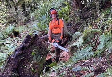
We finally conquored the Arete Sidle track, between Cow Creek hut and Arete Forks hut in the Tararua Forest Park. First stage began August when the team of Alistair Barr, Dave Eaton and Derrick Field flew into Arete Forks hut. The work had been deferred until approval to use chainsaws was obtained from local DOC. Dave was our qualified chainsaw operator and has a long history of working in the forestry industry, as well as backcountry work like this job.
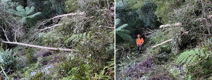
Photo above- Chainsaw operator Dave Eaton with one of the logs cleared off the track
Funding for this long overdue maintennce on the Arete Sidle track was generaously provided to the TARHC by the Masterton Trust House Foundation. Without it, the maintenance would never have happened. The project also included recutting the tracks in the Lower Waingawa valley, the Barra and Barton tracks and also upstream towards Cow Creek hut. Funding for this was recieved from the TARHC. The TARHC recieve an annual grant from DOC Masterton to enable the group to undertake hut and track upkeep in the forest parks.
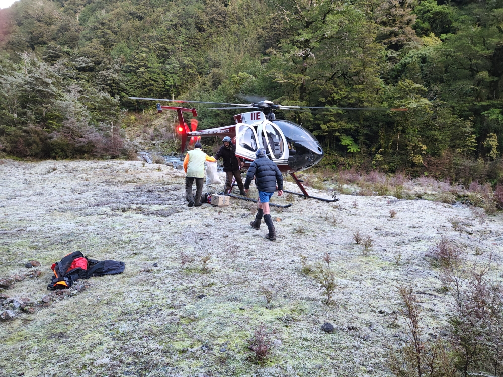
The team were flown in by pilot JD of Amalgamated Helicopters to Arete Forks. After working from Arete Forks JD shifted us to Cow Creek hut.
The forecast break in the weather never lasted long, and with an extended period of wet weather due, the team retreated to town untill weather improved. On 28 August the team with Alistair back at work, now included AndrewRowland and returned to Cow Creek hut to finish the tracks.
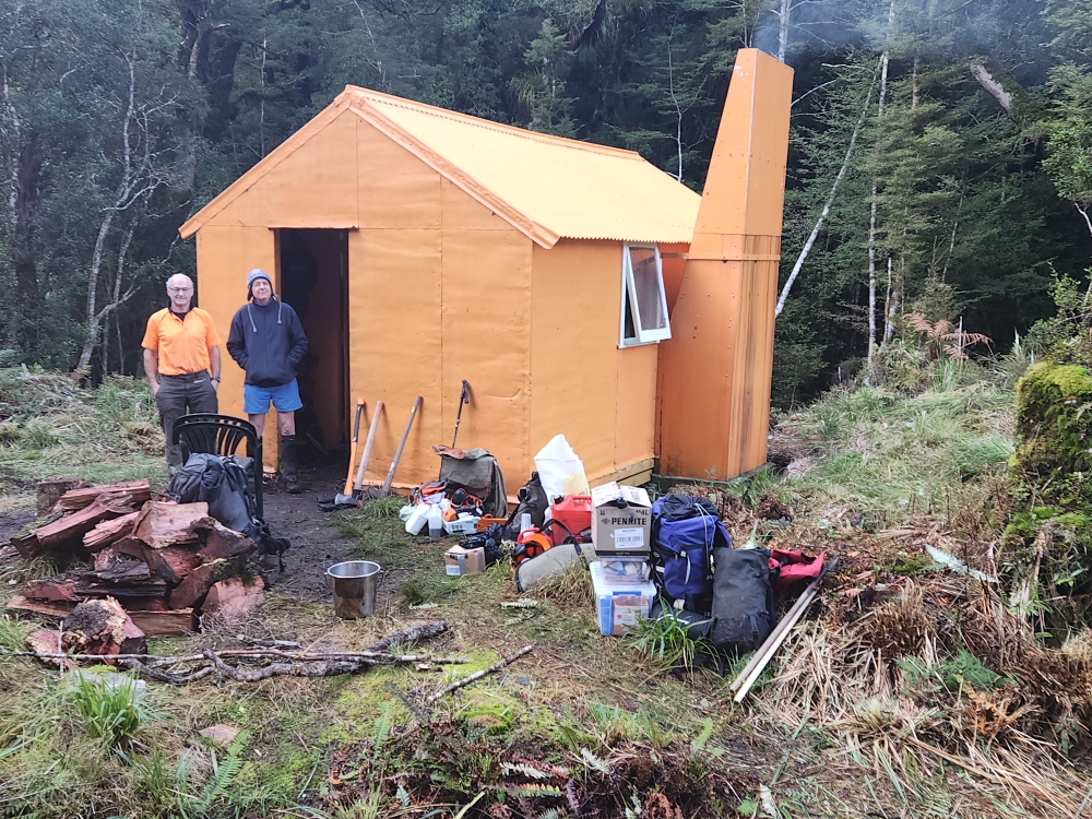
The team unloading at Arete Forks hut.
Our qualified chainsaw operator, Dave Eaton cleared some big logs on the tracks. Many years of tree fall have been cleared making the going a lot easier.
Below – Dave clearing windfall
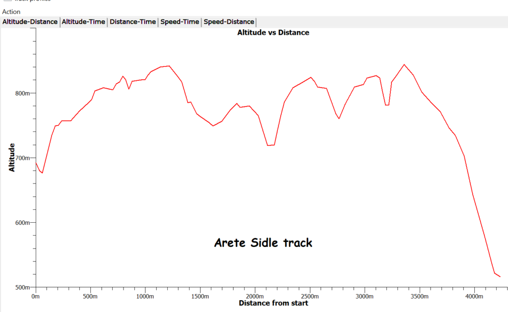
Toughest part of the track work was on the Arete Sidle track. Carting a scrub bar or chainsaw plus tools, gear, and fuel over a few days made for fairly hard going, with long days spent on the track. The track profile below begins at Arete Forks and ends at Cow Creek. NB the map length is 4.7 kms but the actual GPS length is about 5.7 kms. Normal time for most trampers appears to be 5-6 hours. Sometimes much more. This should have been reduced now.
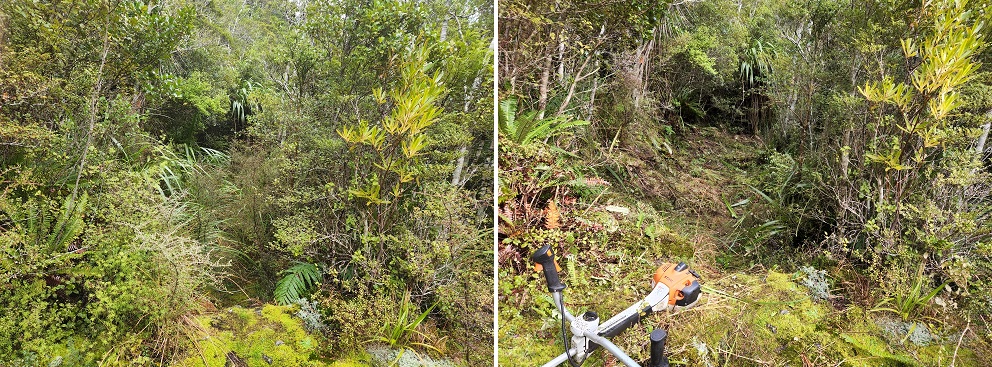
Celaring the track was a combi nation of cutting regenerating vegetation using a Stihl scrub bar and Dave removing winfall using a chainsaw. On the Sidle track, 3 full days using the scrub bar was required, and also 4 long days with the chainsaw.
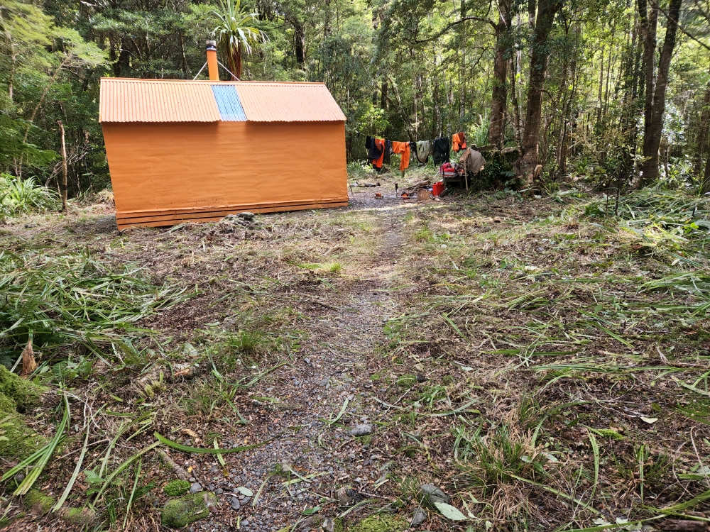
First job at Arete Forks and Cow Creek was replentish the firewood supply and clear the regenerating Astelias, Toitoi, Pepperwood etc that has taken over the hut surronds.
Alistair clearing cut Astelias and Flax that were blocking the track.
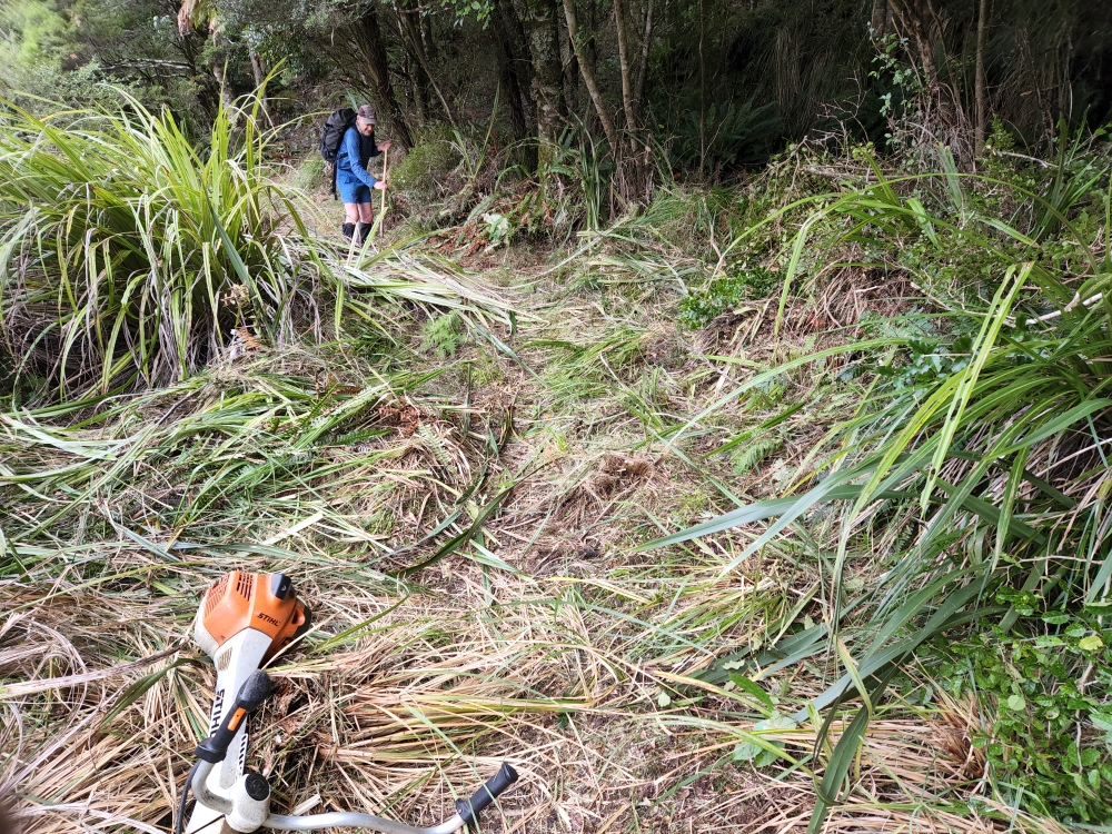
Below – before and after
Ready for relocation from Arete Forks to Cow Creek hut
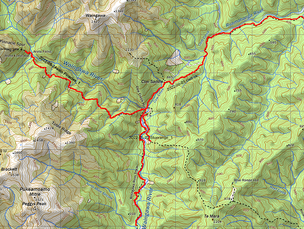
Other tracks cleared from Cow Creek were the Waingawa river track downstream to North Mitre Stream (The Mitre Flats end had been completed in late April 2022). Remarking and windfalls were cleared on the Cow saddle – Cleft creek -Lower Ruamahanga tracks. This route has been cleared to the Mt Bruce roadend
The map below shows tracks completed in the upper waingawa and Ruamahanga. A total of 21 kms of track was recut over 10 days work.
This completes the clearing of the track network from the Kaituna roadend (Barra Track) through the Waingawa and Lower Ruamahanga.
Big thanks to Trust House Foundation funding for making this project possible